Draw
Assign accounts by clicking them, or select a whole area at once. Work at state, county, or ZIP, and lasso a region to grab everything inside it.

A national territory map down to the ZIP, off your own book or an upload. Draw it, balance it, export it.
One tool for the whole territory job. Start from your accounts or a blank map, and end with a plan that is balanced, defensible, and ready to hand off.
Assign accounts by clicking them, or select a whole area at once. Work at state, county, or ZIP, and lasso a region to grab everything inside it.
One button balances your territories on bed count or account count, respecting the ones you lock. Every territory shows its deviation from the ideal, so fair is something you can see.
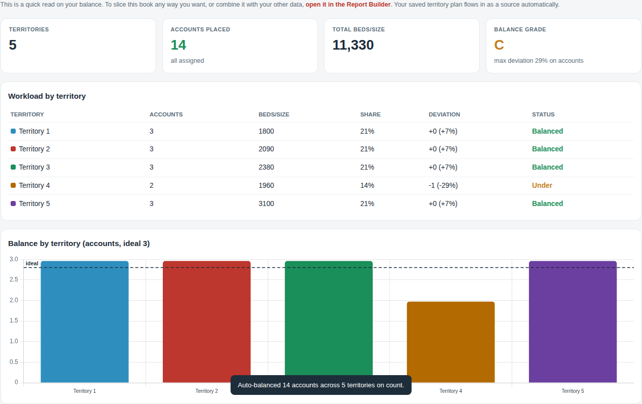
Flip to the report and read the whole plan: workload per territory, share of the book, a balance grade, and the whitespace you have not covered yet.
Take it with you. A 300dpi map for the handout, and a clean geographic CSV you can load into any other tool to rebuild the territories from scratch.
Accounts colored by territory, balanced into compact shapes, on real geography from state down to ZIP.

Switch between state, county, and ZIP. Draw a loop around a region and ProxiMap grabs every area inside it, then shows you exactly what that selection does to your balance before you commit. Click to drop the ones you caught by accident.
Balance on beds or accounts with one button, or nudge only the territories that are out of range. Each one reports its deviation and percent from the ideal, with anything over fifteen percent flagged, the same numbers a territory planner lives by.
Workload per territory, share of the book, a balance grade, whitespace, and a chart against the ideal line.
The heavy mapping tools make you fill a thousand fields, sit through a training, and pay per seat before you draw a single line. ProxiMap does the part reps actually use: draw, balance, export. It runs in the browser, it works on a list you upload, and it prices like a tool, not a platform.
Priced like an add-on, not a platform.
$49 a month standalone on your own uploaded book, or free inside Pro if you already own a line. No per-seat math, no thousand-field setup. Pro connects it to the rest of the suite and syncs it to your CRM when you are ready.